Explore Your Photos with Maperture
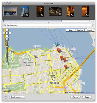
Maperture is a free photography application designed for Mac users, offering an intuitive way to organize and manage photos. This multimedia tool allows users to create dynamic maps that showcase the locations where their images were taken, enhancing the storytelling aspect of photography. With its user-friendly interface, Maperture enables easy navigation through images, making it simple to categorize and explore photo collections based on geographical data.
Top Recommended Alternative
The application is particularly beneficial for travel enthusiasts and photographers who wish to visualize their journeys. Maperture's mapping feature integrates seamlessly with existing photo libraries, allowing for efficient tagging and sorting. By providing a unique perspective on photo organization, it transforms how users interact with their images, turning a simple photo library into an engaging visual experience.